 Innsbruck Tours
Home › Guides › Innsbruck Map: Sights, Cable Cars and Transport
Innsbruck Map: Sights, Cable Cars and Transport
This Innsbruck map puts the Old Town sights, the Nordkette cable car stations, Bergisel, Schloss Ambras and the main transport stops on one interactive sheet. It covers where each pin sits, how far apart they are, which tickets and hours apply, and what lies outside the frame, such as Swarovski Crystal Worlds in Wattens. The Golden Roof, the Hofburg and the Court Church sit within a few minutes of each other, and the Hungerburg funicular leaves from Congress station at the edge of the Old Town. Use the pins to plan a day on foot, then pick from the Innsbruck tours that start inside the same small grid.
Quick answer Where everything sits on the Innsbruck map
The Hofburg is a 3-minute walk from the Golden Roof, so the Old Town sights on the Innsbruck map form one tight cluster. The Hungerburg funicular leaves from Congress station at Rennweg 3 and reaches Hungerburg in 8 minutes. Bergisel sits south of the centre, Schloss Ambras sits east, and Swarovski Crystal Worlds is in Wattens, outside the city map.
Key takeaways
- The full ride to the top starts at Congress station: compare the Nordkettenbahn tickets before you go.
- Bergisel is a tram ride south on line 1 to Stift Wilten, see where Bergisel sits.
- Swarovski Crystal Worlds needs the shuttle or a Swarovski ticket with transport.
- Hall in Tirol, about 8 km away, is the closest town to Innsbruck.
Interactive Innsbruck Map
Every pin below is a sight, a cable car station, a museum, a listed restaurant or a transport hub in Innsbruck. Tap a pin for its hours or price and a link to the guide that covers it.
Map data © OpenStreetMap contributors. Hours and prices from the official sites.
What Does the Innsbruck Map Show in the Old Town?
It shows the Golden Roof, the City Tower, the Hofburg, the Court Church and St James Cathedral packed into a few lanes, with Maria-Theresien-Strasse running south.
The blue pins sit so close that the Old Town reads as a single cluster on the map. You walk between them in a few minutes.
The Golden Roof Cluster
Start at the Golden Roof. Emperor Maximilian I had it built between 1497 and 1500, and it carries 2,657 gilded copper shingles. The City Tower stands at Herzog-Friedrich-Strasse 21, a few steps away. It has 133 steps up to a viewing platform 31 m high, and the tower itself is 51 m tall.
The Hofburg is a 3-minute walk from the Golden Roof and 15 minutes on foot from the train station. The Court Church and the Tyrolean Folk Art Museum sit next to the Hofburg. Inside the Court Church, Maximilian I's tomb is surrounded by 28 larger-than-life bronze statues, eight of them women. St James Cathedral closes the cluster on its north side.
| Pin | Hours | Adult ticket |
|---|---|---|
| Golden Roof Museum | Tuesday to Sunday 10:00-17:00, closed Monday | €6.00 |
| City Tower | 10:00-17:00, longer in season | €4.50 |
| Hofburg | Daily 9:00-17:00, last entry 16:30 | €16.00 combo |
| Court Church | Monday to Saturday 9:00-17:00, Sunday 12:30-17:00 | €9 State Museums single ticket |
| Tyrolean Folk Art Museum | Daily 9:00-17:00, last entry 16:30 | €9 State Museums single ticket |
Reading the Table Above
The table lists the Old Town pins with the hours and adult prices each venue publishes. The Hofburg figure is the combo for the Imperial Apartments plus Maximilian1. Children up to 19 enter the Hofburg free. Under 19s also enter the Tyrolean State Museums houses free, and the combined State Museums ticket costs €14. The City Tower stays open until 20:00 from June to September and from 15 November to 23 December. A combined Golden Roof, City Museum and City Tower ticket costs €10.50.
All five pins sit inside one short walk. A guided walk such as the Per Pedes Welcome Tour of Innsbruck Old Town at $21 covers the same lanes in 1 hour with a licensed Austria Guide.
South Along Maria-Theresien-Strasse
Walk south out of the Old Town and the map opens onto Maria-Theresien-Strasse. Two pins mark it: St Anne's Column in the middle and the Triumphal Arch at the south end. From 25 November to 6 January the street holds a Christmas market with 30 stalls, open daily 11:00 to 21:00.
Across the Inn river, the map shows the painted houses of Mariahilf. The Markthalle sits on the Old Town side of the river at Herzog-Siegmund-Ufer 1-3, with more than 40 vendors.
Sources: City of Innsbruck, Tirol Tourism, Burghauptmannschaft Austria, Tyrolean State Museums, Christkindlmarkt Innsbruck.
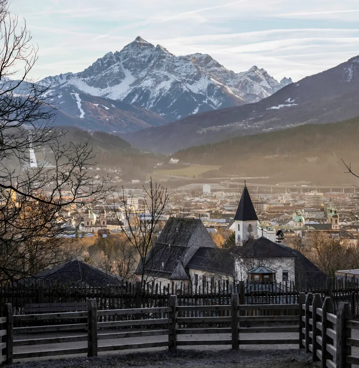
The city sits in a narrow valley between mountain ranges. Photo: Wilfredor, CC0, via Wikimedia Commons
Where Are the Nordkette Cable Car Stations on the Map?
The line starts at Congress station on Rennweg 3 at the edge of the Old Town and climbs north to Hungerburg, Seegrube and Hafelekar.
The green pins form one line pointing north. It is the only part of the map that climbs.
From Congress Station to Hungerburg
The Hungerburg funicular, designed by Zaha Hadid and opened in December 2007, has four stations: Congress, Löwenhaus, Alpenzoo and Hungerburg. It takes 8 minutes from the Old Town to Hungerburg. The Alpenzoo stop is optional, and the zoo sits at 750 m.
The Alpenzoo is also a 20-minute walk from the historic city centre, so it is the one mountain pin you can reach on foot. Dogs are not allowed inside the zoo. Adult entry costs €16.00, and a funicular plus Alpenzoo combi ticket costs €23.00 on the zoo's own price list.
| Station | Height | Return from Innsbruck, adult |
|---|---|---|
| Hungerburg | Hill district above the city | €15.30 |
| Seegrube | 1,905 m | €53.10 |
| Hafelekar (Top of Innsbruck) | Station 2,256 m, summit 2,334 m | €59.00 |
Reading the Station Table
The table above lists each station with its height and the adult return fare from the Nordkette tariff page, valid from 20 November to 25 April. Cars run every 15 minutes, and continuously when guest numbers are high. All three lifts are closed for maintenance from 2 to 19 November, and the winter season runs from 20 November to 25 April.
Next to the Hafelekar station, the Karwendelblick viewpoint looks over Austria's largest nature park. The Top of Innsbruck Nordkette Cable Car Ticket at $66 covers the funicular and both cable cars to Hafelekar. The Hungerburg Funicular Round-Trip Ticket at $17 covers the funicular only.
Sources: Nordkette Cable Railways, Nordkette Cable Railways, Nordkette Cable Railways, Alpenzoo Innsbruck.
Where Are Bergisel and Schloss Ambras on the Map?
Bergisel sits south of the centre past Wilten, and Schloss Ambras sits east of the centre at Schlossstrasse 20.
Two purple pins lie outside the Old Town walk. Each needs a tram or bus.
Bergisel to the South
Tram line 1 runs to Stift Wilten, a few minutes' walk from the Bergisel entrance. The Sightseer stops at Tirol Panorama, about 5 minutes on foot. The ski jump tower was designed by Zaha Hadid, and the hill hosted Olympic ski jumping in 1964, 1976 and 2012.
Adult admission is €12.00 and includes the inclined lift and the tower lift to Bergisel SKY. From November to May the stadium opens Wednesday to Monday 9:00 to 17:00 and closes on Tuesday. It is closed from 9 to 13 November for revision work. Next door, TIROL PANORAMA shows the Giant Panorama Painting of the third Battle of Bergisel of 1809 on 1,000 square metres. A Bergisel combination ticket with that museum costs €16.00.
Schloss Ambras to the East
Schloss Ambras sits at Schlossstrasse 20. Reach it by bus line M to the stop Schloss Ambras, by post bus 540 from the main station, or by tram 3 or 6 plus a 6 to 15 minute walk. The castle is open daily 10:00 to 17:00 and closed in November.
Admission is €16 online and €18 on site for adults. Children and young adults enter free. Ambras is billed as the first museum in the world still standing where it was founded. The Schloss Ambras Entrance Ticket costs $18 and covers entry without the audio guide.
Patscherkofel and Igls
The last mountain pin is the Patscherkofel valley station in Igls, on the hill south of town. Its winter season starts on 12 December. The Innsbruck Card includes one round trip each on the Nordkette lifts and the Patscherkofel cable car, so both mountain pins can sit on the same pass.
Sources: Bergisel Ski Jump, Bergisel Ski Jump, Tyrolean State Museums, Ambras Castle Innsbruck, Patscherkofel Cable Railways.
Tours That Fit
Tickets that start at the pins above.
 from $66
Most booked
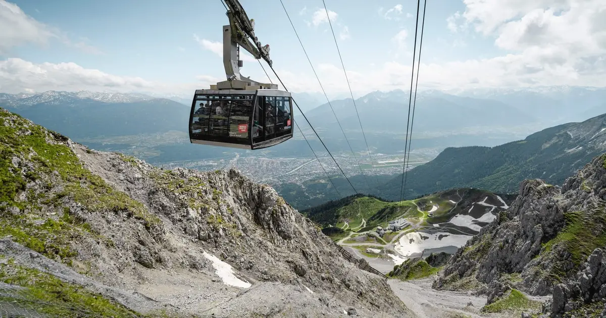
Top of Innsbruck Nordkette Cable Car Ticket
The most-booked ticket: the funicular and both cable cars from the Old Town to the Top of Innsbruck and back.
Check Availability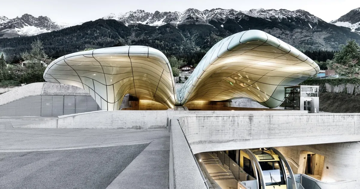 from $17
Hungerburg Funicular Round-Trip Ticket
The short version: the Hungerburg funicular up and back for the city view, without the cable cars.
Check Availability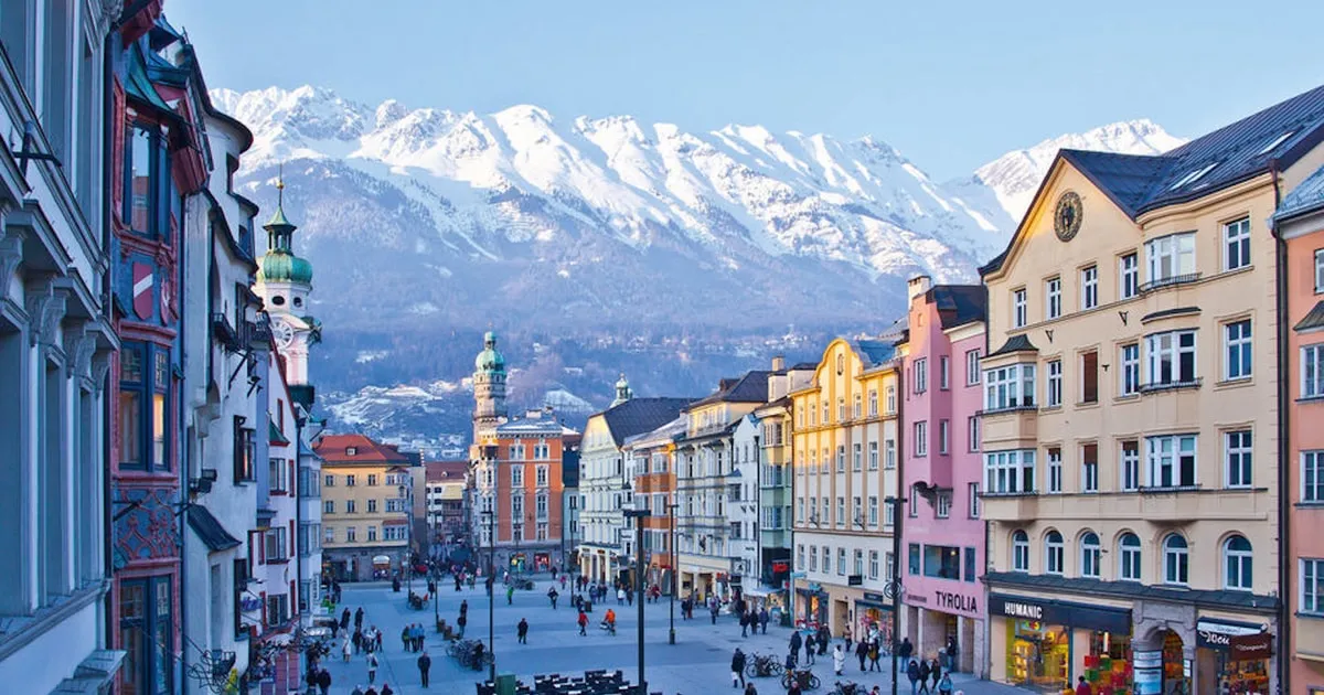 from $77
City pass
Innsbruck Card with Public Transport
The city pass: museums, buses and trams, the Swarovski shuttle and one Nordkette round trip in one card.
Check AvailabilityHow Do You Get Between the Pins?
Walk inside the Old Town and use IVB trams and buses, which a €3.30 single ticket covers for 45 minutes, for Bergisel, Ambras and the station.
The black pins mark Innsbruck main station and the tourist office. Most rides start near one of them.
IVB Tickets for the Map
An IVB single ticket covers one journey with transfers and stays valid for 45 minutes. Buy it online, in the IVB Tickets app, at stop machines or at ticket sales points. Digital tickets must be bought before the ride.
The Sightseer hop-on hop-off bus runs on a 24h ticket that also works on all IVB lines in the Innsbruck core zone.
| IVB ticket | Adult | Reduced |
|---|---|---|
| Single ticket, 45 minutes | €3.30 | €2.20 |
| 24-hour ticket Innsbruck | €7.30 | €5.10 |
| 8-ride ticket Innsbruck | €19.10 | €15.40 |
| 24-hour 2Plus, 2 adults and 3 children | €10.80 | Not offered |
Station, Airport and Tourist Office
The table above shows the IVB fares printed on the operator's ticket page. Bus line F links Innsbruck main station and the city centre with the airport in around 20 minutes. Its stop for the Hofburg is Congress. The tourist information office is at Burggraben 3, where the Innsbruck Card is sold. The 48-hour card costs €79 for adults and covers public transport within Innsbruck and as far as Hall in Tirol.
On foot, the Hofburg is 15 minutes from the train station. That makes the main station the natural first pin for anyone arriving by rail. There are 8 direct train connections from Munich to Innsbruck daily.
Sources: IVB Innsbruck Transport, IVB Innsbruck, Innsbruck Airport, Burghauptmannschaft Austria, ÖBB Austrian Railways, Tirol Tourism.
What Lies Outside the Innsbruck Map?
Swarovski Crystal Worlds in Wattens lies outside the city map, reached by a shuttle from Innsbruck main station.
One big sight sits beyond the frame. Plan it as a half day.
Swarovski Crystal Worlds in Wattens
Swarovski Crystal Worlds is open daily 9:00 to 19:00, last entry 18:00. It is closed all day on 9 and 10 November. An adult ticket costs €25 online against €27 on site. The shuttle from Innsbruck main station also stops at Congress and Hofburg. A shuttle-only return costs €13.00 for adults, bought on the bus in cash.
The shuttle day ticket with entry costs €38.00 on the Crystal Worlds page. The Swarovski Crystal Worlds Ticket and Shuttle from Innsbruck costs $38 and covers entry plus the round-trip shuttle bus. The entry-only ticket costs $26 and leaves transport to you.
Sources: Swarovski Crystal Worlds, Swarovski Crystal Worlds.
Why Is Innsbruck So Famous?
Innsbruck is famous for the Golden Roof of 1497 to 1500, Olympic ski jumping on Bergisel in 1964, 1976 and 2012, and a funicular that climbs from the Old Town to the Nordkette.
The map shows all three reasons within a short ride of each other.
Three Pins That Explain It
The Golden Roof is the emblem of the Old Town, with 2,657 gilded copper shingles on the south facade of the Neuhof. Bergisel hosted Olympic ski jumping in 1964, 1976 and 2012, and its tower was designed by Zaha Hadid. The Hungerburg funicular, also by Zaha Hadid, runs from Congress station to Hungerburg in 8 minutes, and the cable cars continue to Hafelekar at 2,334 m.
Few cities let you stand under a late Gothic balcony and on an Alpine summit on the same morning. On the map, the distance between those two pins is one line of green dots. That is the reason most visitors come.
Sources: City of Innsbruck, Bergisel Ski Jump, Nordkette Cable Railways, Nordkette Cable Railways.
Is Innsbruck in the Alps or Dolomites?
Innsbruck is in the Austrian Alps, below the Nordkette range of the Karwendel, not in the Dolomites.
The mountain pins on the map answer this one.
The Ranges Around the City
North of the city, the Nordkette lifts climb to Hafelekar, with the summit at 2,334 m. Next to the station, the Karwendelblick viewpoint looks over Austria's largest nature park, the Karwendel. South of the city, Patscherkofel rises above Igls. Further south, the Stubai Glacier has slopes over 3,000 m.
The Dolomites are a separate range in Italy, beyond the frame of any Innsbruck map. A day trip such as tandem paragliding in the Stubai Valley at $142.09 keeps you in Tyrol.
Sources: Nordkette Cable Railways, Patscherkofel Cable Railways, Stubai Glacier Cable Cars.
What Is the Closest City to Innsbruck?
Hall in Tirol, about 8 km from Innsbruck, is the closest town, and the Innsbruck Card covers public transport that far.
Hall is the first pin you would add east of the city.
Hall in Tirol
Hall in Tirol is about 8 km from Innsbruck. The Innsbruck Card covers public transport within Innsbruck and as far as Hall, so the town fits on the same pass as the city sights. Wattens, with Swarovski Crystal Worlds, lies further east along the same valley.
The Innsbruck Card with Public Transport costs $77 and covers museums and sights once each, IVB buses and trams, the Sightseer bus, the Swarovski shuttle, and one Nordkette and one Patscherkofel round trip.
Sources: Hall-Wattens Tourism, ÖBB Austrian Railways.
What Is Nicer, Salzburg or Innsbruck?
Innsbruck is nicer if you want an Old Town and an Alpine summit on one map, with the summit at 2,334 m reached from the city centre.
Nicer depends on what you want the map to hold.
What the Innsbruck Map Gives You
The Innsbruck map puts the Golden Roof, the Hofburg and the Court Church within a few minutes of each other. From Congress station, the funicular reaches Hungerburg in 8 minutes and the cable cars continue to Hafelekar. Bergisel, with its Olympic ski jump, is one tram line away.
If mountains on the doorstep matter most, Innsbruck wins. If you want a city without a cable car in it, read the full Innsbruck vs Salzburg comparison before you choose.
Sources: Nordkette Cable Railways, Burghauptmannschaft Austria, Bergisel Ski Jump.
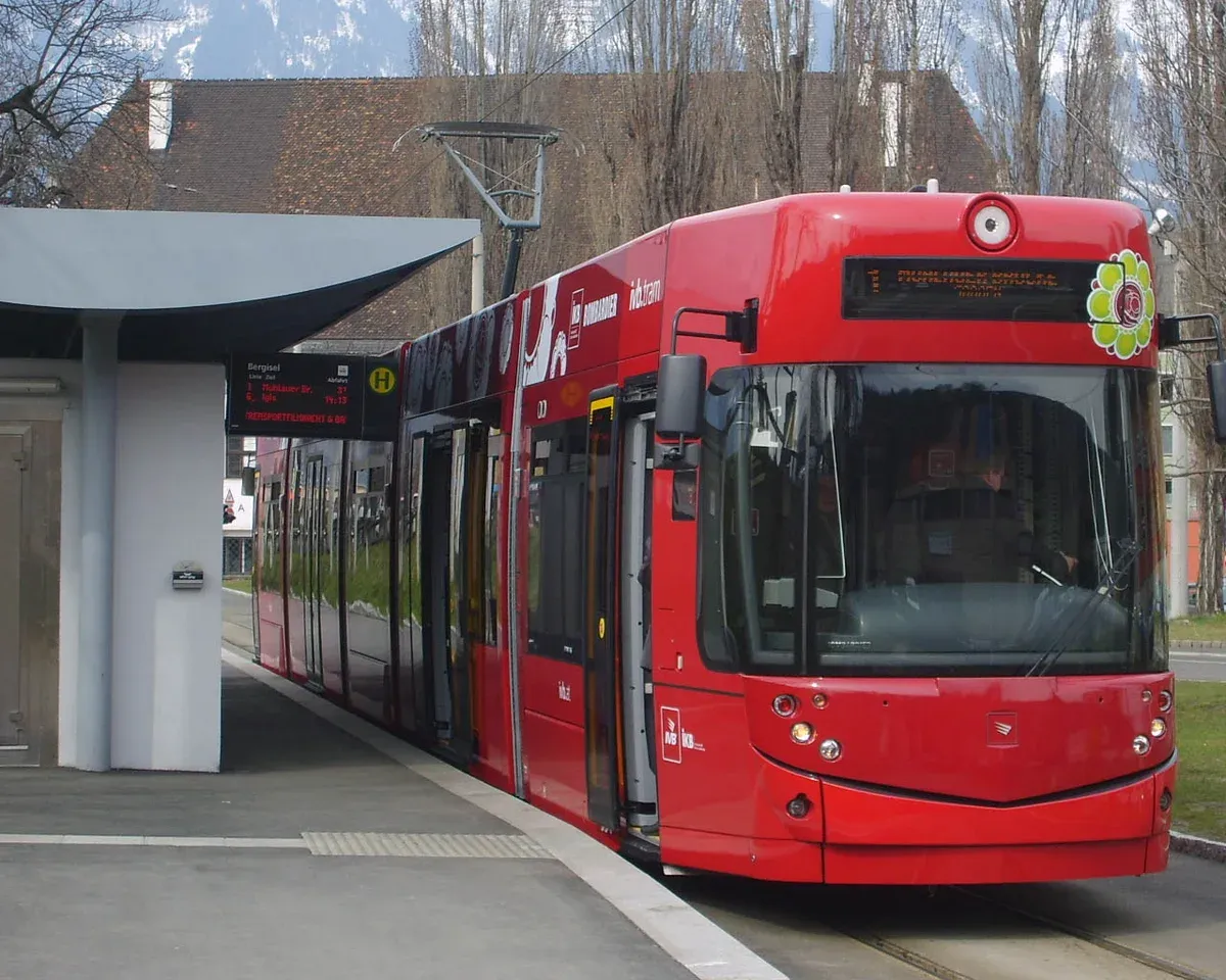
Trams and buses by IVB connect the districts. Photo: Manni Schneiderbauer, CC BY-SA 3.0, via Wikimedia Commons
Innsbruck Map FAQ
Why is Innsbruck so famous?
For the Golden Roof built between 1497 and 1500, Olympic ski jumping on Bergisel in 1964, 1976 and 2012, and the Nordkettenbahn that climbs from the Old Town to 2,334 m.
Is Innsbruck in the Alps or Dolomites?
In the Alps. The Nordkette above the city faces the Karwendel, Austria's largest nature park, as the cable car section shows.
What is the closest city to Innsbruck?
Hall in Tirol, about 8 km away. The Innsbruck Card covers public transport as far as Hall.
What is nicer, Salzburg or Innsbruck?
Innsbruck if you want an Alpine summit reached from the city centre. See the Innsbruck vs Salzburg comparison for the full picture.
Where does the Nordkette cable car start on the map?
At Congress station, Rennweg 3, at the edge of the Old Town. Compare the Nordkettenbahn tickets before you ride.
Is Swarovski Crystal Worlds on the Innsbruck map?
No, it is in Wattens. The Swarovski ticket and shuttle at $38 covers the ride and entry.
How do I get to Bergisel from the Old Town?
Take tram line 1 to Stift Wilten, a few minutes' walk from the entrance, as shown in Bergisel and Ambras.
More Guides
- Best Restaurants in Innsbruck: Where to Eat
Oniriq leads Innsbruck restaurants in 2027 with Gault&Millau 4 toques, 18/20. See the full list by area and check dates.
- Nordkettenbahn: Nordkette Cable Car Tickets from Innsbruck
Ride from the Old Town to Hafelekar at 2,334 m in 2027: summit round trip $66, funicular ticket from $17. Compare tours.
- Innsbruck Card: Prices, What It Includes and Is It Worth It
The Innsbruck Card costs €79 for 48 hours in 2027 and covers 22 sights, buses and the Nordkette. See the prices and compare tours.